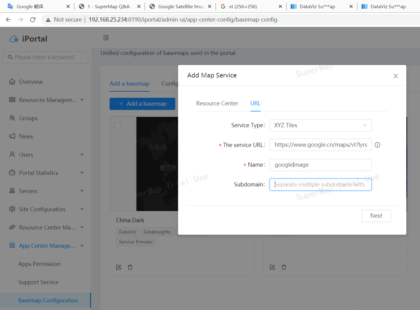
1、login as admin, and then you can config the basemap in this page, set the service Url is https://www.google.cn/maps/vt?lyrs=s@189&gl=cn&x={x}&y={y}&z={z} click Next,and then select DataViz
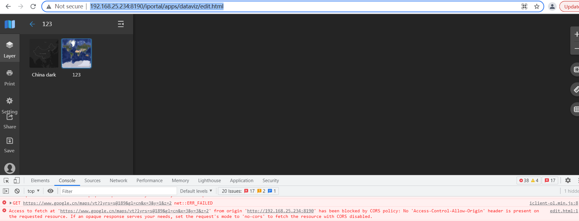
2. open the dataviz http://192.168.25.234:8190/iportal/apps/dataviz/edit.html set the basemap googleImage and we will the the issue from the browser
3、 To solve the issue we should use nginx to proxy the google url. nginx.conf like this
server {

  listen 80;

  server_name yourdomain.com;
  location /google-maps/ {

    proxy_pass https://www.google.cn/maps/;

    add_header 'Access-Control-Allow-Origin' '*' always;

  }

}
4、and then we could use the proxy url http://yourdomain.com/google-maps/vt?lyrs=s@189&gl=cn&x={x}&y={y}&z={z} and repeat the step 1